The Most Important Part of Your Trip
Key safety tips
Don't Forget Your Ordnance Survey Maps
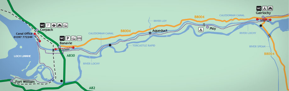
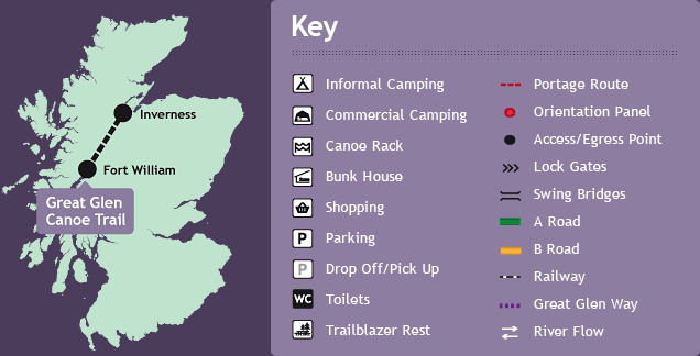
Use the Canoe Trail map in conjunction with your OS maps
Safety
Your safety when on and off the water should be your most important consideration. The Caledonian Canal, at sixty miles long, has a diverse range of waters and paddlers should be aware of what they are getting into before taking on the Canoe Trail.
Only 22 miles of the Caledonian Canal are man-made canal with the remainder crossing four lochs including Loch Lochy (12 miles) and Loch Ness (22 miles). Even though the lochs are inshore, they are classed as open water by the Coastguard. Waves of over three metres in height have been recorded at the end of Loch Ness.
To help you with your trip we have created a short safety video to highlight those conditions and the safety and rescue skills that you and your group may have to undertake when on the Trail. We also offer a free Trail Guide Map to all who register to take on the Trail. This map is designed to compliment the use of Ordanance Survey Landranger maps, not replace them. Safety information and emergency contact details are highlighted on the Trail Guide Map for your convienence.
There are some simple rules to follow when taking to the canal and the loch sections of the Great Glen Canoe Trail.